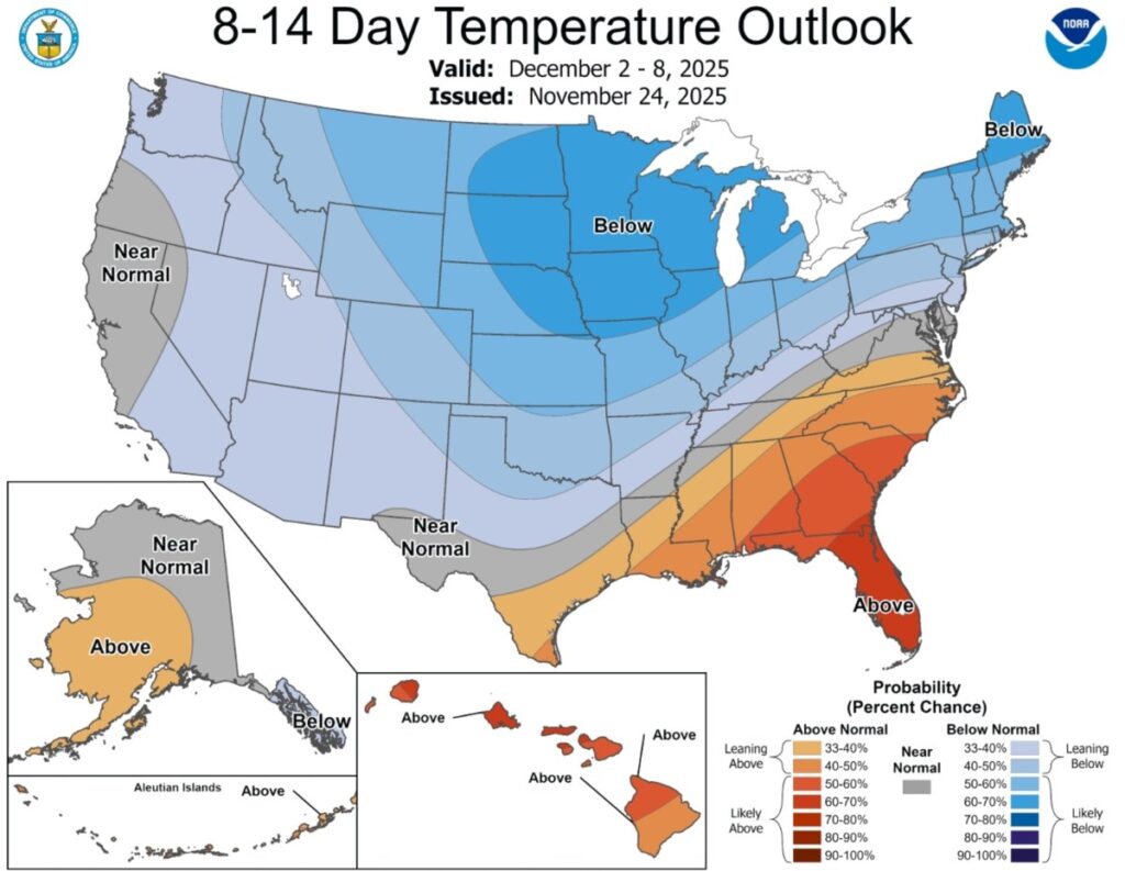
The National Weather Service (NWS) Climate Prediction Center has reported potential below-average temperatures across the Northern Plains, upper Midwest, Great Lakes, and parts of the Northeast due to the rare phenomenon of sudden stratospheric warming (SSW), which is expected to disrupt the polar vortex significantly by late November or early December. This disruption may allow frigid Arctic air to sweep into North America, altering weather patterns.
The latest temperature outlook forecasts below-average temperatures particularly in states like North Dakota, South Dakota, Nebraska, and Minnesota, with a lower chance extending into central Texas. Although above-average temperatures may persist in the Southeast, experts warn that the impacts of SSW could lead to wintry conditions across much of the U.S.
Meteorologist Ben Knoll noted that this SSW event could be the earliest on record. As Arctic air moves south and a high-pressure system develops over Russia, several episodes of frigid air and possibly increased snowfall are expected, especially in the northern U.S. Residents in affected areas are advised to monitor updates as the situation unfolds.
Source link


