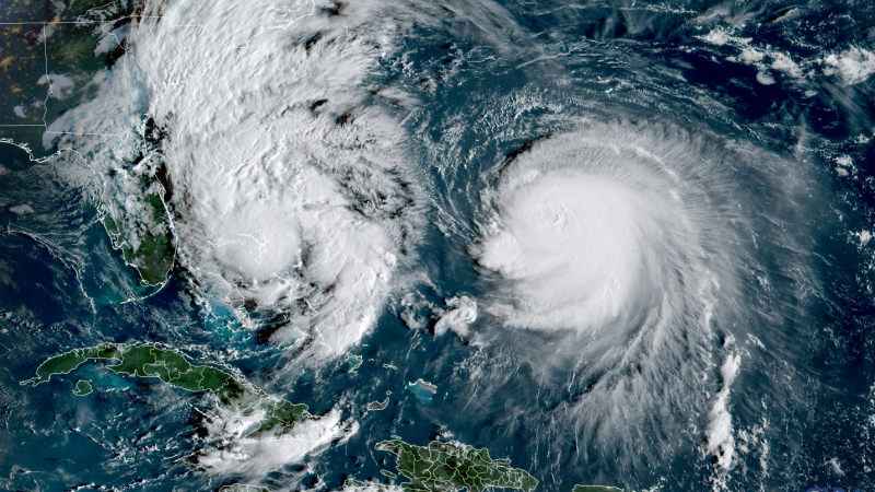
Tropical Storm Imelda is expected to strengthen into a hurricane this week as it moves along the southeast coast, bringing dangerous surf, rip tides, and potential coastal flooding from Florida to the Carolinas. Meanwhile, Hurricane Humbel, which briefly reached Category 5 status, is now a large Category 4 hurricane located far from Imelda but still impacting US beaches with significant wave action.
Imelda’s center is predicted to remain far from the US coast, shifting forecasts from earlier predictions. Local flash flooding is possible in Coastal Carolina through Tuesday, but overall rainfall predictions have dropped. Coastal flooding is also a concern from Florida to North Carolina as winds could push water levels up to 2 feet above low tide.
In the Bahamas, Imelda continues to cause heavy rainfall and flooding, with warnings in effect. As of Monday, Imelda had winds of 50 mph and is expected to strengthen on Tuesday. Its northward movement is influenced by Humbel, which is expected to pull Imelda further away from the coast, reducing wind damage risks but not flood threats.
Emergency preparations are underway in the southeast, with South Carolina and North Carolina governors declaring emergencies. Bermuda faces potential impacts from both storms, particularly as Humbel passes nearby.
Historically, the US has avoided direct hurricane landings this season, and if this continues, it could mark the first season without a direct hit in recent history. However, the season has been notable for several major hurricanes and increased rapid strengthening, attributed to climate change effects.
Source link


