Summary
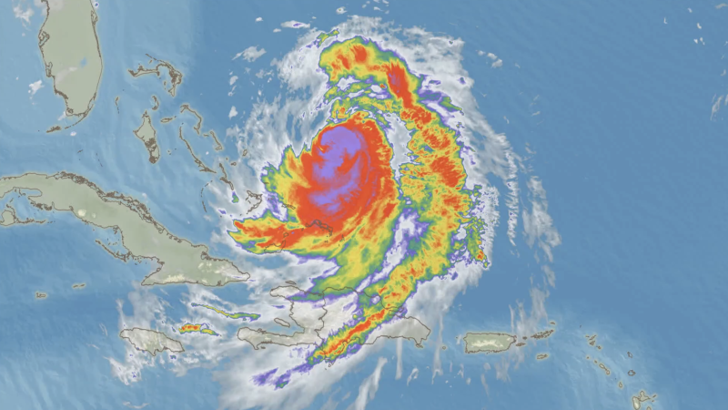
Hurricane Erin, a powerful Category 3 hurricane, is currently impacting the U.S. East Coast, though it is not predicted to make landfall. The storm has caused life-threatening surf conditions, particularly in North Carolina, where officials reported numerous rescues due to rip currents. A non-swim advisory has been issued for Wrightsville Beach, and evacuations have been mandated in parts of Dare and Hyde counties, including Hatteras and Ocracoke Islands.
The hurricane’s outer bands have already affected Bermuda and the Bahamas, resulting in floods, blackouts, and airport closures, with Puerto Rico also experiencing severe weather. There is also a 60% chance that Erin will develop into further tropical disturbances in the coming week.
Erin is expected to maintain its strength as a significant hurricane with waves potentially exceeding 20 feet, leading to significant coastal flooding and erosion, especially in the Outer Banks. The storm intensified rapidly over the weekend, becoming a Category 5 hurricane at its peak and expanding its impact area.
Experts note that the recent strength of hurricanes like Erin highlights the potential for rapid intensification due to warming ocean conditions, a crucial part of the ongoing hurricane season, which typically peaks from mid-August to mid-October.


