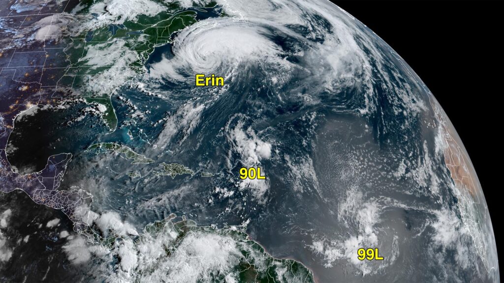
Hurricane Erin has been churning in the North Atlantic, positioned southeast of New England. This powerful storm is causing rip currents along the US East Coast, Bermuda, and parts of Atlantic Canada. As of Friday morning, Erin, with winds of 90 mph, was situated between Bermuda and Halifax and was expected to transition into a mid-latitude cyclone. Despite this transition, the hurricane’s wind strength could persist.
Coastal flooding peaked on Thursday night, particularly affecting locations such as Duck, North Carolina, and areas in Virginia, with nine states experiencing varying degrees of flooding. Tragically, flash floods linked to Erin led to nine fatalities shortly before the storm was named.
Additionally, a new system dubbed Invest 90L, which could develop into a tropical storm by early next week, is being monitored. It is moving towards Bermuda and is expected to have warm sea surface temperatures in its path, although it might be influenced by Erin’s cold water.
Another system, Invest 99L, is developing more slowly due to dry air and wind shear but is still under observation as it moves toward the Windward Islands. The National Hurricane Center has indicated moderate chances for both systems to intensify.
Source link


