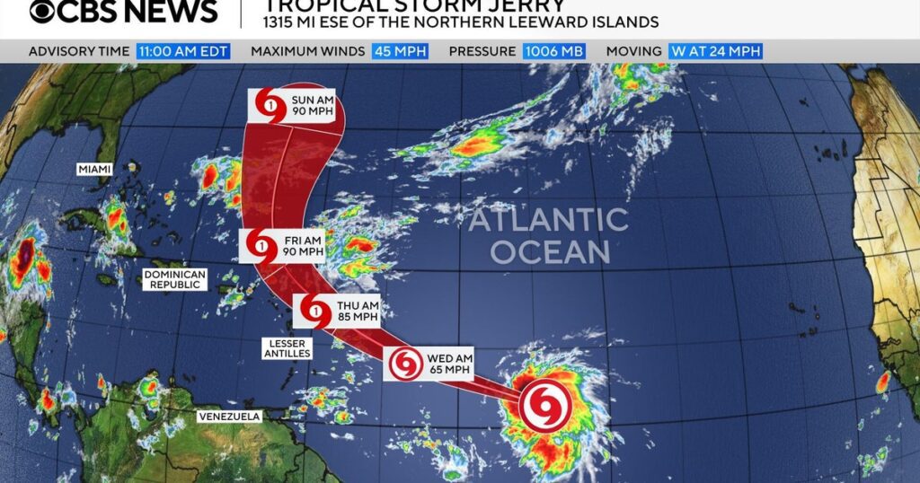
Tropical Storm Jerry formed in the Central Atlantic on Tuesday, becoming the 10th named storm of the 2025 hurricane season, as reported by the National Hurricane Center. At the time of the announcement, Jerry was over 1,300 miles east-southeast of the Northern Leeward Islands, moving west at 25 mph with maximum winds of 50 mph. Forecasters anticipate the storm will strengthen and could approach the Northern Leeward Islands by Thursday or Friday, although it is not expected to make landfall. Tropical storm watches are in effect for several Caribbean islands, with the potential for dangerous surf conditions and up to 4 inches of rain leading to flash floods.
Jerry follows several other Atlantic storms, including Hurricanes Hambelt and Imelda, which had previously impacted Bermuda and the southeastern U.S., causing erosion. This hurricane season has been relatively quiet, with only one prior storm, Chantal, making landfall in the U.S. NOAA had initially predicted 13-19 named storms for the season, but has since adjusted expectations to 13-18 storms.
Overall, Jerry’s development marks an active point in a season characterized by lower-than-expected storm activity compared to initial forecasts.
Source link


